Is There a Tsunami Warning for San Francisco and What Should You Do Right Now?
As of July 1, 2026, there is currently NO active Tsunami Warning, Advisory, Watch, or Threat for San Francisco or the surrounding Bay Area coastline. Residents and visitors do not need to evacuate at this time.
Data verified against the official U.S. Tsunami Warning Centers. Always check official government sources for real-time updates during a seismic event.
Living on the edge of the Pacific Ring of Fire means that seismic activity is a constant reality for Bay Area residents. While earthquakes are the most immediate threat, the secondary hazard of a tsunami requires an entirely different set of preparedness protocols. Understanding whether you are in danger—and exactly how to respond if an alert is issued—can mean the difference between safety and catastrophe.
This article details the current state of tsunami monitoring in San Francisco, explains why you should never wait for an emergency siren, and provides neighborhood-specific evacuation strategies tailored to the unique geography of the city.
Current Tsunami Status and Official Alerts for the San Francisco Bay Area
The National Tsunami Warning Center (NTWC) continuously monitors seismic data across the Pacific Ocean. When an earthquake occurs, scientists rapidly analyze the location, depth, and magnitude to determine if a tsunami has been generated. For San Francisco, threats are generally categorized into two distinct timelines: distant sources and local sources.
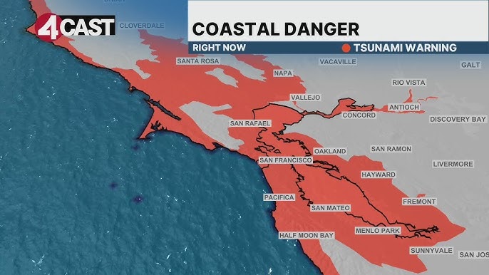
Image source: YouTube
Distant Source Tsunamis (Hours to Prepare)
A distant source tsunami is generated by a massive earthquake far across the Pacific Ocean. Historically, the most significant threats to the California coast originate from the Aleutian Trench near Alaska or the Kamchatka Peninsula in Russia. According to historical data, a magnitude 8.7 or higher earthquake in these regions is a primary trigger for distant-source warnings in San Francisco.
Because these waves must travel thousands of miles across the ocean, the Bay Area typically has anywhere from 8 to 12 hours of advance notice. This provides ample time for the city to issue official alerts, close beaches, secure the Embarcadero, and execute orderly evacuations of low-lying coastal zones.
Local Source Tsunamis (Minutes to Prepare)
A local source tsunami presents a much more severe logistical challenge. If a major earthquake occurs on an offshore fault line near the California coast—such as the Cascadia Subduction Zone to the north—a tsunami could reach the shores of Ocean Beach and enter the Golden Gate in as little as 10 to 15 minutes.
In a local source scenario, there is no time for the government to issue a text message or television alert. Emergency management officials stress that you must rely on "Nature's Warning." If you are near the coast and feel a strong earthquake that makes it difficult to stand, or if the shaking lasts longer than 20 seconds, do not wait for an official alert. Move to high ground immediately.
Why You Will Not Hear an Emergency Siren in San Francisco
One of the most dangerous misconceptions among San Francisco residents is the expectation that an audible outdoor siren will warn them of an approaching tsunami. This expectation is rooted in the city's history, as a network of 119 outdoor warning sirens was installed during the Cold War and utilized for decades.
However, San Francisco's emergency siren network is currently defunct. The system was taken offline years ago for a planned upgrade that was ultimately abandoned due to budget constraints and shifting technological priorities. The city has explicitly stated that there are no plans to revive the outdoor siren system. Instead, San Francisco relies entirely on digital notification systems.
San Francisco vs. Neighboring Counties
This lack of sirens is specific to San Francisco proper. If you cross the county line, the infrastructure changes. For example, San Mateo County maintains an active outdoor warning siren system specifically for coastal communities like Pacifica and Half Moon Bay. San Mateo tests these sirens on the first Wednesday of every month at 10:00 AM.
| Notification Method | San Francisco County | San Mateo County |
|---|---|---|
| Outdoor Sirens | ❌ NO (System is defunct) | ✅ YES (Tested 1st Wed of month) |
| Wireless Emergency Alerts (WEA) | ✅ YES (Automatic to cell phones) | ✅ YES (Automatic to cell phones) |
| Opt-In Text Alerts | ✅ YES (AlertSF - Text ZIP to 888-777) | ✅ YES (SMC Alert) |
| Social Media Updates | ✅ YES (@SF_Emergency) | ✅ YES (@SanMateoCo) |
Because you will not hear a siren in San Francisco, it is imperative that residents ensure their mobile devices are configured to receive Wireless Emergency Alerts (WEA) and that they are registered for the local AlertSF text message system.
How to Evacuate Based on Your Specific San Francisco Neighborhood
San Francisco's topography is highly varied, featuring steep hills directly adjacent to flat, low-lying landfill areas. The official Tsunami Hazard Area map (often referred to as the "Purple Zone" due to its color-coding on state maps) dictates exactly who needs to evacuate. "Moving inland" is a vague instruction in a dense urban environment; residents need specific geographic boundaries.
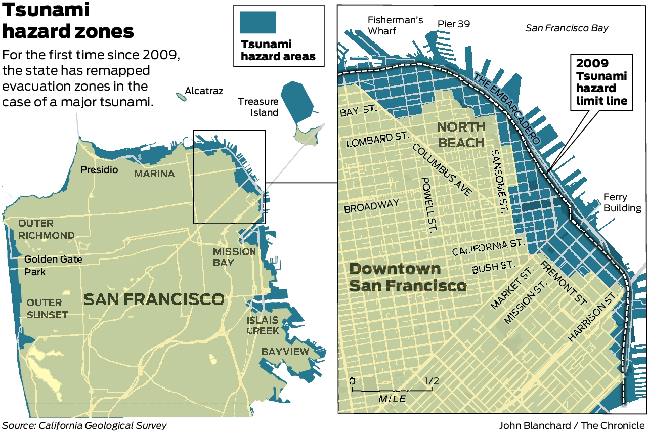
Image source: San Francisco Chronicle
The western edge of the city faces the open ocean, making it highly vulnerable to direct wave impact. The Great Highway and the lower avenues of the Sunset and Richmond districts are in the primary hazard zone. Evacuation Strategy: Move east of 19th Avenue. The elevation rises significantly past this thoroughfare, providing a natural barrier against coastal flooding.
The Marina faces a dual threat. Not only is it a low-lying coastal area, but it is also built on landfill, making it highly susceptible to soil liquefaction during the earthquake that precedes a local tsunami. Evacuation Strategy: Abandon vehicles immediately, as roads may buckle or flood. Move south toward the steep inclines of Pacific Heights (south of Lombard Street).
While the waves entering the San Francisco Bay through the Golden Gate will lose some energy, the dense waterfront along the Embarcadero remains a high-risk inundation zone. Evacuation Strategy: Move west of 2nd Street or utilize vertical evacuation in modern high-rise buildings if street-level evacuation is blocked by debris or gridlock.
What to Do if a Tsunami Hits While You Are Commuting on BART or a Bridge
A significant portion of the Bay Area population commutes across or under the water daily. A tsunami warning issued during rush hour presents complex logistical challenges. The standard advice to "move to high ground" requires context when you are trapped in transit infrastructure.
BART Riders in the Transbay Tube
If you are riding BART through the Transbay Tube between San Francisco and Oakland during a tsunami event, your immediate physical safety from the wave impact is relatively secure. The tube is buried in a trench on the floor of the bay and is engineered to withstand immense hydrostatic pressure. The primary risk to the BART system during a tsunami is not the tube collapsing, but rather the flooding of low-lying stations (such as Embarcadero) and widespread power failures.
If a warning is issued, BART operators are trained to hold trains at safe, elevated stations or proceed to the nearest station outside the inundation zone. Riders should remain on the train and follow the conductor's instructions. Attempting to self-evacuate into the dark tunnels is highly dangerous due to the electrified third rail and the risk of incoming water at station portals.
Drivers on the Bay Bridge and Golden Gate Bridge
The road decks of both the Golden Gate Bridge and the San Francisco-Oakland Bay Bridge are situated hundreds of feet above the water level, placing them far above any conceivable tsunami wave height. If you are on the suspended portion of either bridge, you are technically on "high ground."
However, the danger lies in the bridge approaches. The toll plazas, the MacArthur Maze, and the Embarcadero off-ramps are all located in low-lying hazard zones. If traffic comes to a standstill, you must not remain in your vehicle if it is parked in an inundation zone near the water's edge. In a severe local-source event with minutes to spare, abandoning your vehicle and moving to higher ground on foot is a highly recommended approach.
During a city-wide evacuation, San Francisco's streets will almost certainly experience immediate and severe gridlock. Relying on a car to escape a tsunami in SF is a critical mistake. Foot evacuation or utilizing a bicycle is widely regarded as one of the most effective methods to navigate the congested urban grid during an emergency.
The Difference Between a Tsunami Warning, Advisory, and Watch
Understanding the specific terminology used by the National Weather Service is vital. Not every alert requires a full-scale evacuation of the city. The alerts are tiered based on the severity of the expected impact.
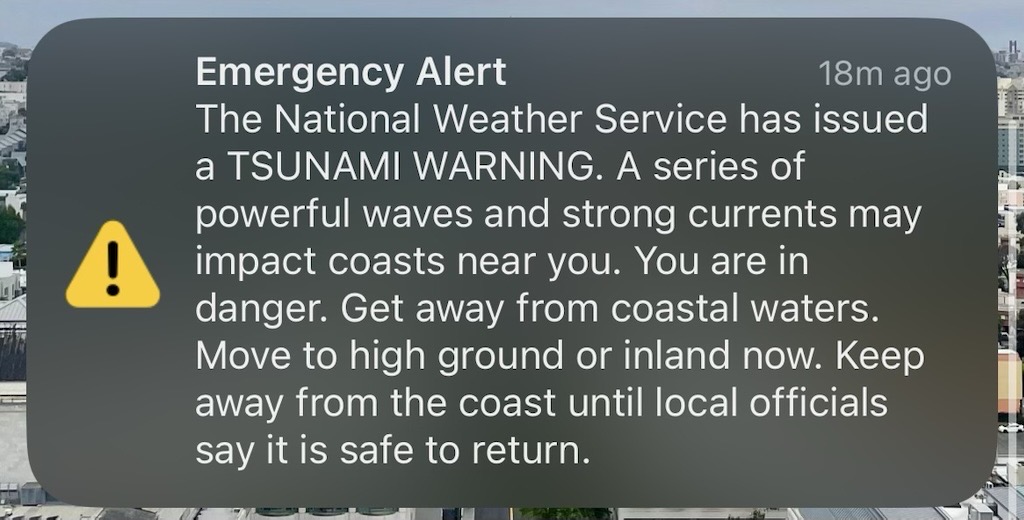
Image source: x.com
- Tsunami Warning (Highest Danger)
- A Warning means that a tsunami with the potential to cause widespread inundation is imminent or expected. Dangerous coastal flooding accompanied by powerful currents is likely. Action Required: Full evacuation of designated hazard zones is mandatory. Move to high ground or inland immediately.
- Tsunami Advisory (Strong Currents)
- An Advisory indicates that a tsunami capable of producing strong currents or waves dangerous to those in or very near the water is expected. According to experts cited by ABC7 News, advisories are not "minor" events; they pose a severe threat to surfers, boaters, and beachgoers. The wave height may only be 1 to 3 feet, but the volume of water moving can easily sweep a person out to sea. Action Required: Stay out of the water and away from beaches, marinas, and breakwaters. Widespread city evacuation is typically not required.
- Tsunami Watch (Potential Danger)
- A Watch is issued when a distant earthquake has occurred that might have generated a tsunami, but the threat is not yet confirmed. Action Required: Stay tuned to local news, check your emergency supplies, and be prepared to act if the Watch is upgraded to a Warning or Advisory.
How to Use Vertical Evacuation if You Cannot Reach High Ground
In certain areas of San Francisco, such as the deep Financial District or the flat expanse of the South of Market (SoMa) neighborhood, reaching natural high ground within a 15-minute window may be physically impossible, especially for individuals with mobility issues or during severe traffic gridlock.
In these scenarios, emergency management protocols suggest utilizing Vertical Evacuation as a last resort. This involves moving to the upper floors of a sturdy, multi-story building to escape the floodwaters.
The 3rd Floor Rule and Building Selection
According to preparedness guidelines highlighted by KQED, vertical evacuation should only be attempted in specific types of structures. You must move to the third floor or higher of a reinforced concrete or steel-frame building. These modern commercial or high-rise residential buildings are engineered to withstand significant lateral forces, including seismic shaking and hydrodynamic wave impact.
Conversely, you should never attempt vertical evacuation in a wood-frame structure, such as the traditional Victorian homes found in the Marina or the Sunset districts. Wood-frame buildings lack the structural integrity to withstand the sheer force of a tsunami wave and the accompanying debris; they are highly susceptible to being swept off their foundations.
Why Some Tsunami Alerts Turn Out to Be False Alarms
Living in a coastal earthquake zone means occasionally dealing with canceled alerts. A notable example occurred when a tsunami warning was issued for the Bay Area following a seismic event, only to be canceled shortly after when wave models were updated.
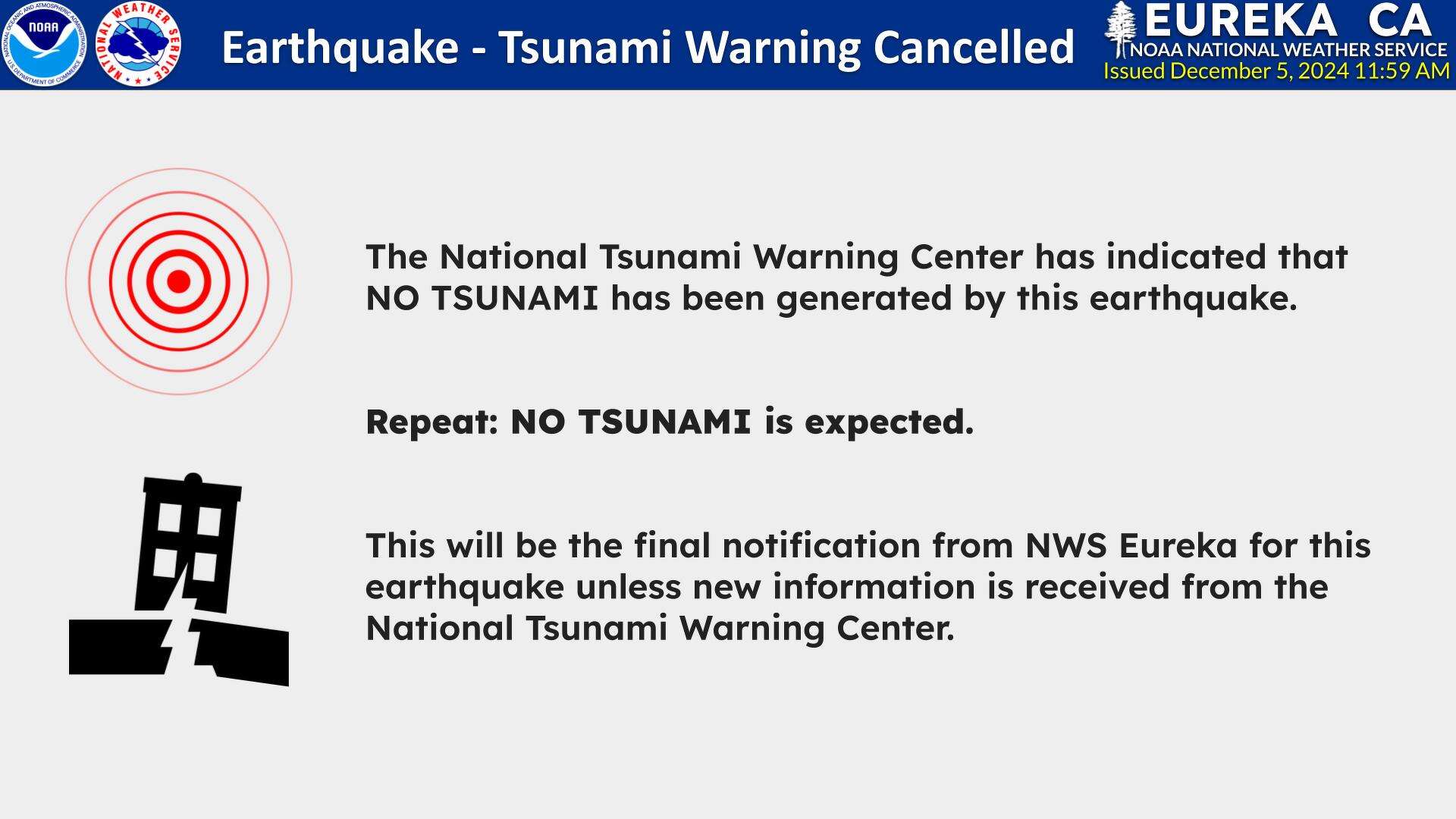
Image source: San Francisco Chronicle
These incidents often lead to a dangerous psychological phenomenon known as "alert fatigue," where residents begin to ignore future warnings, assuming they will also be false alarms. However, emergency officials issue conservative warnings by design. The science of predicting tsunami wave heights is incredibly complex, relying on deep-ocean buoys and mathematical models of the seafloor (bathymetry).
A wave that measures only 1 foot in the deep ocean can amplify dramatically as it approaches the shallow coastal shelf. Furthermore, geographic variance plays a massive role. A tsunami that results in a manageable 1-foot surge inside the protected San Francisco Bay can simultaneously manifest as a destructive 5-foot wave in Crescent City, California, due to the specific shape of the coastline. Because the initial alert must cover broad regions, officials operate on a "better safe than sorry" rationale. Ignoring an alert because the last one was a "dud" is a risk that safety experts strongly advise against.
Frequently Asked Questions
Is there a tsunami warning in San Francisco right now?
As of July 1, 2026, there is no active tsunami warning, advisory, or watch for San Francisco. Always verify current conditions directly through the National Tsunami Warning Center (Tsunami.gov) or local emergency broadcasts, as status can change rapidly following a seismic event.
How much time do I have to evacuate SF before a tsunami hits?
The timeline depends entirely on the source of the earthquake. A "distant source" tsunami (e.g., from an earthquake in Alaska or Japan) provides 8 to 12 hours of warning. A "local source" tsunami (e.g., from an offshore California fault) could reach the San Francisco coast in as little as 10 to 15 minutes, leaving no time for official alerts.
Are the San Francisco emergency sirens working?
No. San Francisco's outdoor emergency siren system is defunct and offline. The city relies on the Wireless Emergency Alerts (WEA) system sent to mobile phones and the opt-in AlertSF text message system. Do not wait to hear a siren before evacuating.
Is the Sunset District safe from tsunamis?
The lower avenues of the Sunset District (near the Great Highway and Ocean Beach) are in a high-risk inundation zone. However, the elevation rises as you move inland. Areas east of 19th Avenue are generally considered safe from tsunami flooding due to their higher elevation.
Can a tsunami knock down the Golden Gate Bridge?
It is highly unlikely. The road deck of the Golden Gate Bridge is approximately 220 feet above the water, placing it well above any recorded or modeled tsunami wave height. The primary danger lies in the low-lying approach roads leading to the bridge, which can easily flood.
What is the highest ground in San Francisco?
Mount Davidson is the highest natural point in San Francisco at 928 feet, followed closely by Twin Peaks at 922 feet. However, you do not need to reach the highest peak to be safe; moving just 100 feet above sea level or a few miles inland is typically sufficient to escape tsunami inundation.
What should I pack in a tsunami Go-Bag?
A tsunami Go-Bag should be lightweight since you may need to evacuate on foot. Essential items include bottled water, a battery-powered or hand-crank emergency radio, a physical map of the city, basic first aid supplies, and sturdy, thick-soled shoes to protect your feet from broken glass and debris.
Will my cell phone work during a tsunami evacuation?
You should expect significant cellular network disruptions. During a major earthquake or tsunami warning, cell towers often become overloaded with traffic or lose power. This is why having a physical meeting plan with your family and a battery-operated radio for official updates is a highly recommended preparedness step.
Final Safety Checklist and Key Takeaways
Surviving a tsunami in a dense urban environment like San Francisco requires prior planning and a clear understanding of the city's unique geography and alert systems. Keep these critical points in mind:
- Sign up for AlertSF by texting your ZIP code to 888-777, as the city's outdoor sirens are permanently offline.
- Memorize your hazard zone to know instantly if your home, workplace, or child's school is located within the "Purple Zone" inundation map.
- Plan a foot evacuation route because relying on a vehicle will likely result in being trapped in severe gridlock.
- Move east of 19th Avenue if you are in the Sunset or Richmond districts, or south toward Pacific Heights if you are in the Marina.
- Utilize vertical evacuation (3rd floor or higher) in reinforced concrete buildings only if you are trapped in a low-lying area like the Financial District.
- Trust Nature's Warning and move to high ground immediately if you feel an earthquake that makes it difficult to stand or lasts longer than 20 seconds.